A Brief History of the Haw River, and Issues Impacting It
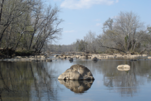
The Haw River flows 110 miles from headwater springs in the eastern edge of Forsyth County down to Chatham County where it meets the Deep River to become the Cape Fear River. The Haw flows through Guilford, Rockingham, Alamance, Orange and Chatham counties, and is fed by tributaries in Caswell, Durham and western Wake counties as well. The watershed encompasses about 1700 square miles
A few hundred years ago, a pristine Haw River flowed through a Piedmont forest of towering chestnuts, white oaks, beeches, sycamores, and tulip trees. These trees provided a dense canopy, and supported an understory of viburnum, mountain laurel, blueberries, wildflowers, and ferns covering the forest floor. Many animals including bears, beavers, deer and wolves made their home in the forest. The Sissipahaw also lived here, in villages near the banks of the Haw River and creeks, with plentiful wild game, fish, mussels and crayfish, berries and nuts as well cultivating the “Three Sisters” crops of corn, squash and beans. These dynamic forests, the native people and many of the animals began to disappear – cut down, or forced out, as white settlers began to arrive in the region in the 1700’s and took over the land.
Over two centuries of farming and timbering dramatically impacted the old growth forest and severely altered the river. Settlements and farms located along the waterways, and sediment from cleared land flowed into streams and the river. Dams were built to turn gristmills. As the South became increasingly industrial in the late 1800’s, textile mills used the Haw River to both provide hydro-power with larger dams, and to disposal of their waste. The impact of this pollution, along with minimum (or no) sewage treatment from towns, fouled the river, making it unsafe for drinking, swimming, and fishing.
The advent of the Clean Water Act in 1972, and better state and local laws significantly helped the Haw River. This Act created new rules to stop pollution including better wastewater and stormwater treatment and rules for industry to pre-treat their waste before dumping it into the river. Unfortunately, the health of the Haw is still in peril. Our history of industrial waste, fast growing populations and deforestation has taken its toll, and new impacts compound the Haw River’s road to recovery.
In 1982, the B. Everett Jordan Reservoir was completed and opened. Known as Jordan Lake, it is a 14,000 acre impoundment of waters of the Haw River right below the confluence with New Hope Creek. Built by the Army Corps of Engineers it flooded New Hope bottomlands in Chatham (and Durham) counties where many farms had been located. Some of the best whitewater rapids on the Haw River were also drowned. Several cites upstream of the lake objected to the impoundment, fearing that urban stormwater and wastewater would create a polluted lake. Indeed, by 2002 Jordan Lake was listed on the EPA Impaired Waters list for excessive algae, caused by excessive nutrients flowing into it, and new state rules were created to reduce that pollution. The rules are still under debate today, and the lake continues to be impaired. Despite this, it is a popular recreation area, drinking water source for over 300,000 people, and home to bald eagles, ospreys and herons.
Today, the Haw watershed is home to over 900,000 people, large agricultural operations, industry, urban areas, and second growth forests. As the population escalates, so does the pace of development, claiming more and more of the Piedmont’s rural land. The ramifications of this can be seen throughout the Haw watershed. Development disturbs existing ground cover and exposes large areas of soil vulnerable to storm run-off. When this erosion occurs, sediment clogs rocky stream bottoms and clouds water. Aquatic plants and animals are then impacted due to loss of habitat and spawning areas.
More people also means more wastewater in our waterways. This nutrient-rich effluent is linked to excessive algal growth and blooms, resulting in low levels of dissolved oxygen and fish kills we often see on the slower moving sections of the Haw in the warmer months. Our urban areas themselves degrade the health of local waterways by concentrating the amount and rate of rain runoff. Rains can then cause scouring flood events and wash pollutants directly into storm sewers and waterways. Climate change has been causing more intense rains and flooding in recent years.
Haw River Assembly was formed in 1982, by people who cared about the health of the river and has grown to over 1000 members, volunteers and supporters from throughout the whole watershed. We have been active advocates for clean water and pollution control, playing a large role in issues such as the Jordan Lake rules, working against fracking and pipelines, stopping industrial and agricultural contamination of the waters, and working for better sedimentation control, stormwater and stream buffer regulations. The Haw River Assembly became a licensed member of the international Waterkeeper Alliance in 2018. We have many programs and volunteer opportunities to educate and connect people to the river including stream monitoring, river clean-ups and teaching schoolchildren at the annual Learning Celebration.
With better enforcement of erosion and pollution controls (and better laws) and a concerted effort to protect stream buffers in the Piedmont, there is hope for the Haw River and its aquatic life, and our drinking waters. New efforts are underway to stop industrial contamination. Implementation of more sustainable planning and growth policies, will enable us to face new threats that will come with climate change here in the Haw River watershed, while supporting the health of the waters.
Water is Life We Must Protect It.